Geologic Issue #1: Wind/Soil Erosion – Loss of Vegetation

Given Iceland’s extremely flat terrains, wind erosion is inevitable. During my trip there, I personally have experienced wind speeds of up to 50km/h (I jokingly said that if I jumped up from one spot, I’d land somewhere else). For example, the Mt. Hekla volcano in Southern Iceland is surrounded by a 110 km2 area that is extremely perceptible to wind erosion, and extreme sediment transport the area experiences leads to sparse vegetations. In the north-eastern part of that area, more than 80% of the surface ground consists of loose sand due to wind erosion, however this characteristic is less prominent closer to the volcano, where the surface mainly comprises of coarse pumice.
Geologic Issue #2: Volcanic Mud and Glacial Outbursts
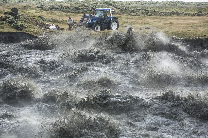
Glacial outbursts, or namely, “glacial lake outburst floods” (GLOF), occur quite infamously in Iceland due to the nation’s sheer number of glaciers. In fact, this phenomenon occurs so often in South Iceland that it is otherwise known as “Jokulhlaup”, which is Icelandic. Due to erosion, buildup of water pressure, an earthquake, volcanic eruptions, or an avalanche, what previously held the glacier water in place (most often just pure glacier ice) collapses and displaces large amounts of water.

A well-known case of Jokulhlaup struck in 1996, when the volcano under the Vatnajokull glacier erupted and the Grimsvotn lakes flooded the Vatnajokull National Park. At a flow rate of 50,000 cubic metres per second, the jokulhlaup destroyed the Iceland Road #1 and its icebergs struck down parts of the Gigjukvisl Bridge. The tsunami ended up being 13 feet high and 660 yards wide, also carrying with it almost 200 million tons of silt.
